


Les Monceaux

phi14
User
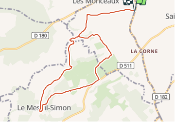

Length
10.5 km

Max alt
172 m

Uphill gradient
167 m
Km-Effort
12.7 km

Min alt
75 m

Downhill gradient
167 m
Boucle
Yes
Creation date :
2023-10-12 12:23:21.166
Updated on :
2023-10-17 16:56:45.047
2h53
Difficulty : Difficult

FREE GPS app for hiking
 SityTrail
IGN / Geographical institutes
SityTrail Plus
The world is yours!
About
Trail Walking of 10.5 km to be discovered at Normandy, Calvados, Les Monceaux. This trail is proposed by phi14.
Positioning
Country:
France
Region :
Normandy
Department/Province :
Calvados
Municipality :
Les Monceaux
Location:
Unknown
Start:(Dec)
Start:(UTM)
291203 ; 5444096 (31U) N.
Comments